Landforms are natural features that shape the Earth’s surface.
They are the result of various geological processes and can be found across the planet, encompassing a wide range of shapes, sizes, and formations. Landforms are natural features on the Earth's surface, such as mountains, hills, valleys, and plains, that shape the terrain.
Landforms provide valuable insights into the Earth’s history and are crucial in understanding the dynamic processes that have shaped the planet over millions of years.
The development of landforms is influenced by a variety of factors, including geological, tectonic, climatic, and erosional processes.
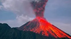
1. Plate Tectonics
The Earth's outer shell is divided into large slabs of solid rock, called “plates,” that glide over the Earth's mantle, the rocky inner layer over Earth’s core.
As these large tectonic plates move they 'bump' into each other. This movement causes changes on the earth surface, resulting in landforms such as mountains, rift valleys and volcanos.
Types of plate movement.
Divergent Boundaries: occurs when two plates slide apart
Convergent Boundaries: occurs when plates collide with one another
Transform Boundaries: occurs when plates move sideways past each other
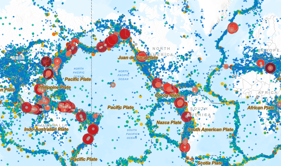
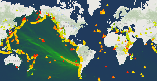
Mapping tectonic plates with ARCGIS
Note: You do not need to sign in for this activity.
We are going to use a GIS program called ARCGIS to map the location of tectonic plate boundaries, earthquakes and active volcanoes.
It will be interesting to see if there is a relationship that shows how tectonic plates are shaping the earth surface.
Are there mountain ranges and volcanoes at tectonic plate boundaries?
Go to the ARCGIS Homepage
Go to the Basemap key to select your base map (Fourth button in the left hand menu)
Selecting Terrain with Labels allows you to see where the mountain ranges are.
Now select the Layers button (Second top button in the left side menu)
Then use the Add layer button to search for layers in the ArcGIS online library.
Change the search from Living Atlas to ArcGIS online (Very important!)
Search for the following three layers to Add to map
Earth’s Tectonic Plates - The red lines represent boundaries between tectonic plates
Global Earthquake Archive
Significant Global Volcanic Eruptions
Screenshot a copy of your completed map.
Record your observations about the distribution of volcanoes and earthquakes relative to tectonic plate boundaries and mountain ranges.
2. Weathering and Erosion
Weathering and erosion are processes by which landforms are broken down and their rocks and dust moved from their original location.
The difference between weathering and erosion is based on whether a rock's location has changed:
Weathering degrades a rock without moving it.
Weathering often leads to erosion by causing rocks to break down into smaller pieces, which erosive forces can then move away.
Erosion carries rocks and soil away from their original locations.
Weathering
Weathering is the breaking down or dissolving of rocks on the surface of the Earth. The process of weathering breaks down and removes material from the coastlines. Weathering wears away exposed surfaces over time.
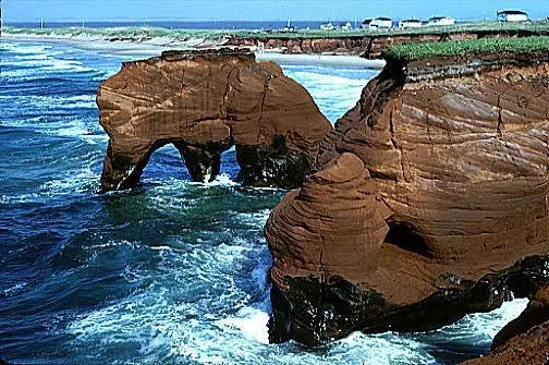
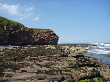
Weathering fieldwork: Dee Why Headland is a result of water weathering
To do: Weathering questions
What is the evidence for the headland at Dee Why being weathered by water?
Erosion
Erosion is the removal of surface material from landforms, primarily soil and rock debris by wind and water. This material is then transported to a different location by the water or wind.
Some rocks weather and erode easily - Sandstone
Some rocks are harder and resist weathering and erosion - Igneous rocks.
Erosion fieldwork: The Grand Canyon is a result of water and wind weathering
To do: Erosion questions
What is the evidence for the Grand Canyon being eroded by water and wind?
3. Landform Scout
In this activity you will examine the formation, weathering and erosion of two famous landforms.
The BBC is going to do a David Attenborough documentary on landforms.
When you finish you will have a report that examines the formation and weathering of two iconic landforms
The producers have asked you to scout locations for two episodes.
Choose two famous landforms that reflect a range of the processes that shape the earth's surface.
For each landform you will need to research the following information.
Title slide
Location - where is the landform located. (General map and a local map)
Satellite image - what is the local environment like?
Formation - explain, using diagrams, how each landforms was formed (EG. The tectonic process).
Formation - use pictures to show the formation of the landform (weathering / erosion )
Conservation - What strategies are in place so that your landforms are protected for future generations? Are they effective?
Don't forget
Include labelled photos of each landform.
Refer to your images and maps in the text.

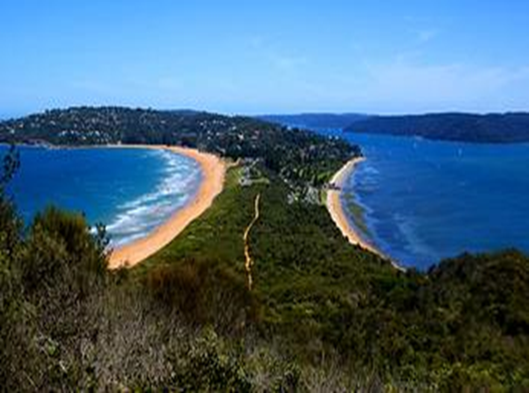
4. Coasts
Heading to the coast
The coast is where the land meets the sea.
Waves, tides, and currents help create coastlines. When waves crash onto shore, they wear away or erode the land.
Coastal erosion
Coastal landforms are shaped by both erosion and weathering:
Wave action
Wind
Water (Runoff)
Chemical weathering
The coast is constantly being reshaped by erosion and weathering.
This can be a good thing or a bad thing, depending on the location of your house.
Wave action
The force of waves is powerful enough to erode cliffs. And beaches
5. Coastal Fieldwork
8 Geography Virtual Coastal Excursion
Work through the eight stations, using the photos to answer questions in your field
trip booklet.
Once you have completed these questions do the field sketch task on the board
Don’t forget to record any interesting observations.
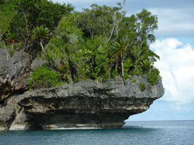
Station 1. Depositional Landforms
Coastal deposition is when the sea drops or deposits material.
This can include sand, sediment, and rocks.
This process of deposition results in depositional landforms.
Questions
Use the diagram above to identify three depositional landforms at both source 1 and 2.
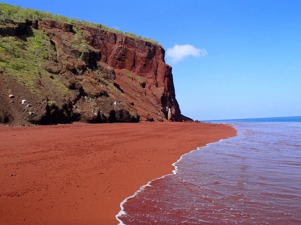
Station 2. Depositional Landforms
Questions
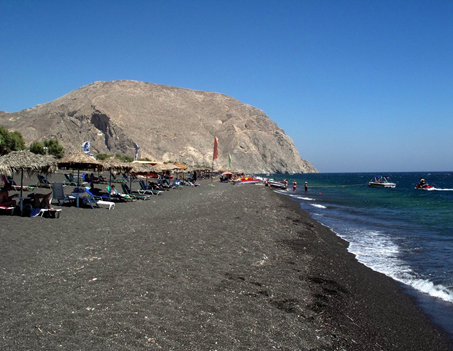
Explain the origin of the colour of the beach sand at source 3 and 4.
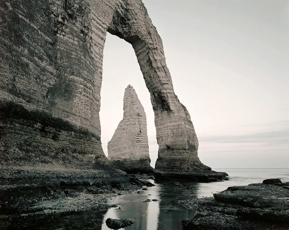
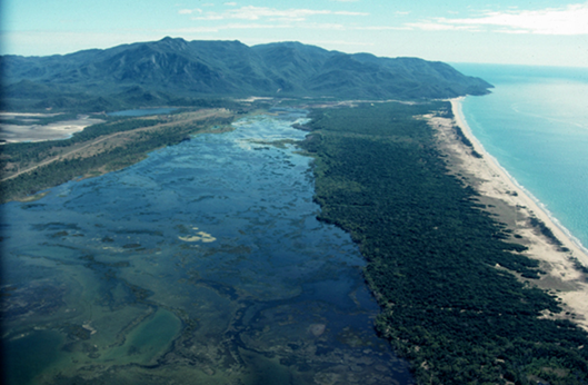
Station 3. Coastal Landforms
Source 5. is a diagram that shows the main coastal landforms.
Questions
What are the forces shaping the landforms in Source 6.
Use the diagram to name three coastal landforms at source 6.
Station 4. Coastal Landforms
Use the diagram in source 5 to answer the questions.
To do: questions
List three coastal landforms in source 7 and 8.
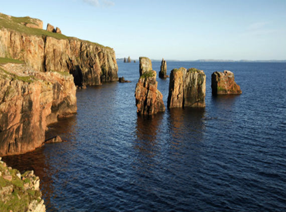
Station 5. Coastal landforms
Questions
What is the feature at source 9 and 10. called?
Use a diagram to explain how it is formed.
The power of water to shape beach landforms
Station 6. Human impact on the coast
Questions
Describe some of the impacts humans have on the coastal zone.

Source 1.
Source 3.

Source 5. Coastal landform diagram
Source 7.
Source 9.
Source 2.
Source 4.
Source 6.
Source 8.
Source 10.
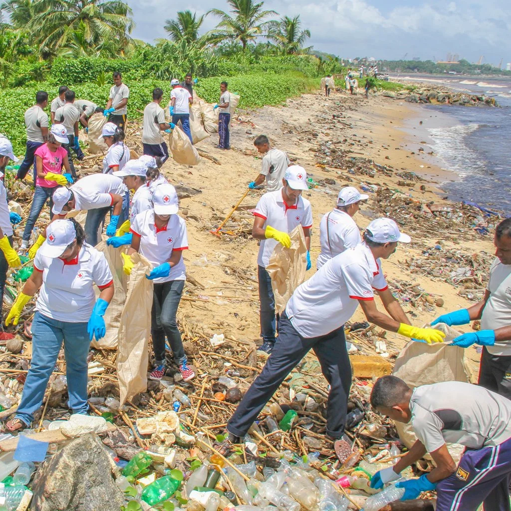
6. The Human impact on the Coast
Human activities and coastal landforms
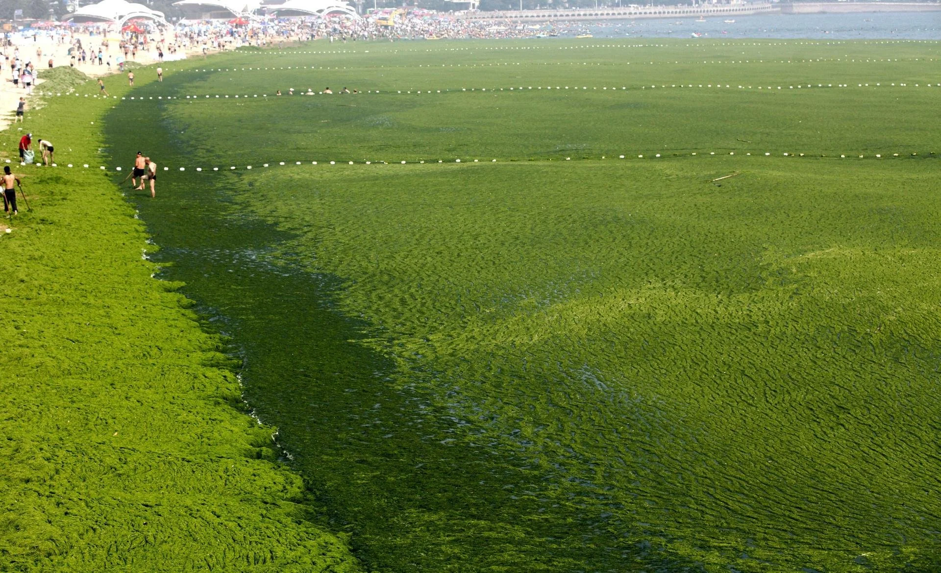
Humans affect coasts by building houses, roads, and tourism facilities that damage dunes and habitats. Pollution from rubbish and industry harms marine life. Overfishing reduces species, while climate change causes erosion and rising seas. Careful management is needed to protect coastlines for people and the environment.
Complete the following virtual fieldwork to learn more about the impact of human activities on the coast before we start your coastal conservation campaign.
Station 1. Watch the video (Source 1) and answer the following questions.
What are the natural processes that are shaping this coast?
Which human activities have shaped the coastline?
Is there evidence of human attempts to manage the erosion of the dunes?
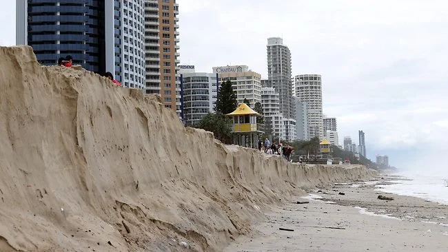
Station 2. Erosion on the coast
Dune systems are natures way of protecting the coast from the natural processes of erosion. Urban development on the coast often replaces these dune systems leading to significant issues.
Describe the reasons for the risk to urban infrastructure in Source 2.
Research and list some possible solutions to this problem.
Station 3 . Human activities impact coasts.
Biodiversity refers to the variety of living species in a region, including plants, animals, bacteria and fungi.
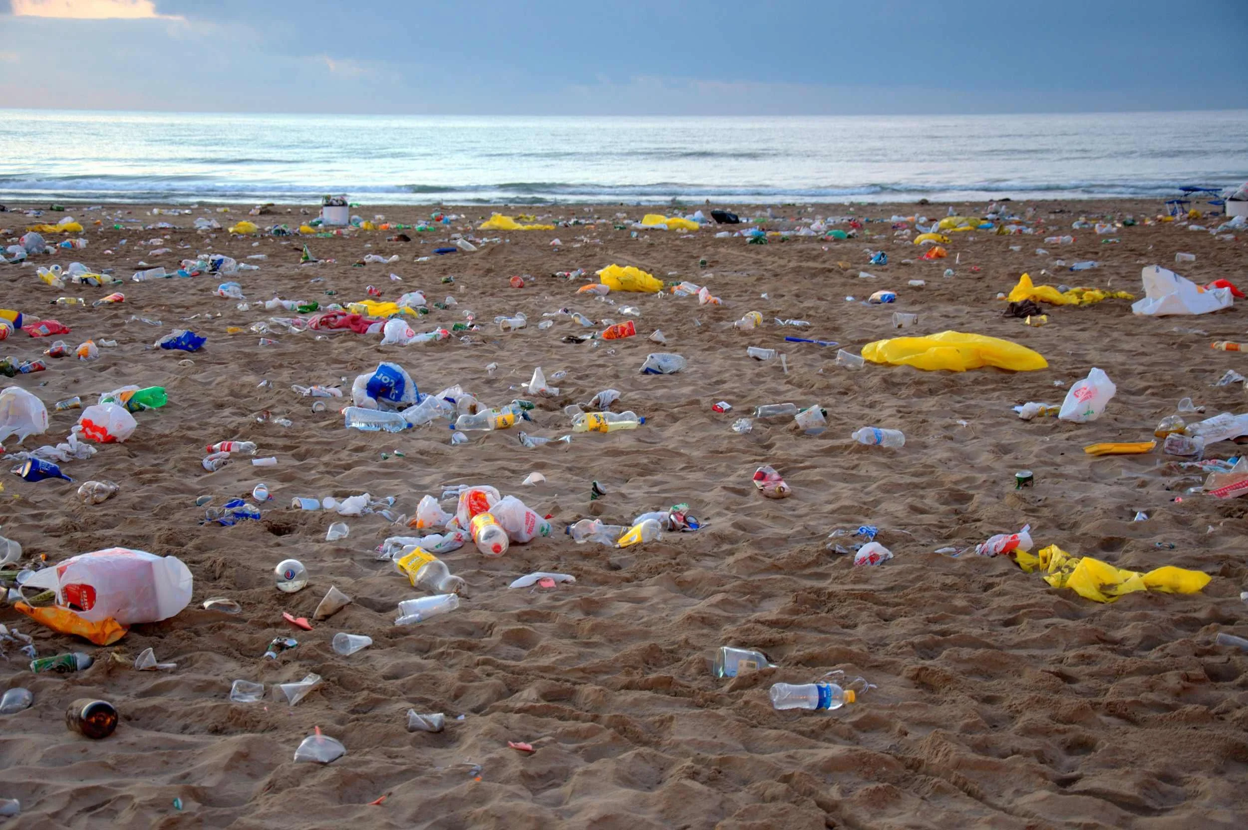
What are the types of human activities that lead to the issues highlighted in Source 3 and 4?
How does plastic pollution impact biodiversity on the coast?
Describe two ways that we could prevent this sort of pollution.
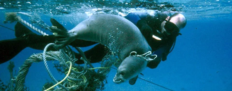
Station 4. Fishing on the coast
Refer to source 5 and 6.
List 5 ways that fishing can impact biodiversity on the coast.
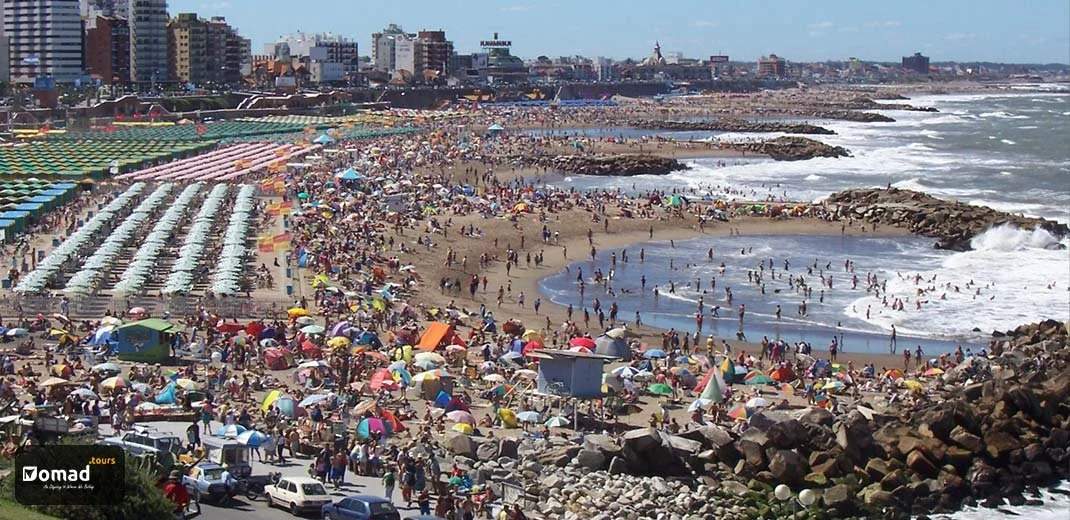
Station 5. Tourism on the coast
Use source 7 to brainstorm the ways tourism can impact the coast
How does Tourism impact coastal landforms?
How does Tourism impact coastal biodiversity ?
Station 6. Development on the coast.
According to NatGeo, ‘In many LEDCs, human impacts on coasts are severe due to rapid population growth, tourism, and unregulated development. Overfishing and mangrove clearance reduce biodiversity, while pollution and waste harm fragile ecosystems. Poor infrastructure and limited services make it difficult to manage erosion, pollution and habitat loss effectively.’
Use the street view in the Gulf of Thailand to identify the following coastal impacts.
Unregulated development
Mangrove clearance (habitat loss)
Reduction in biodiversity
Pollution and waste
Poor infrastructure and limited services
Erosion
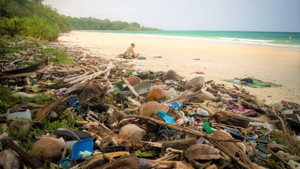
Source 3. Bali Beach
Source 5. Fishing Pollution
Source 1. Coastal erosion report
Source 2. Gold Coast Erosion
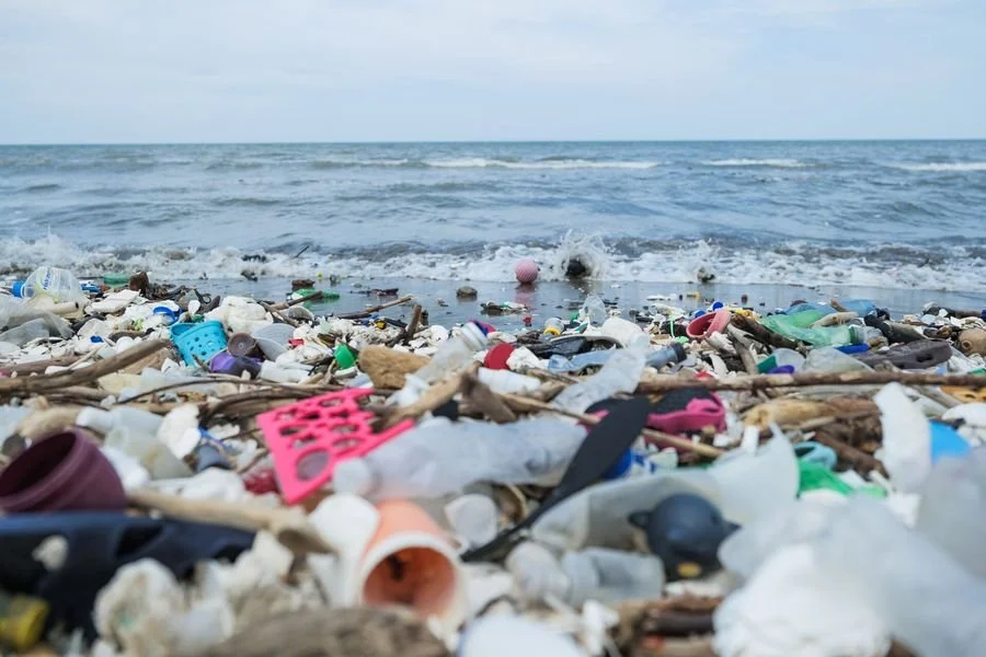
Source 4. North Queensland Plastic
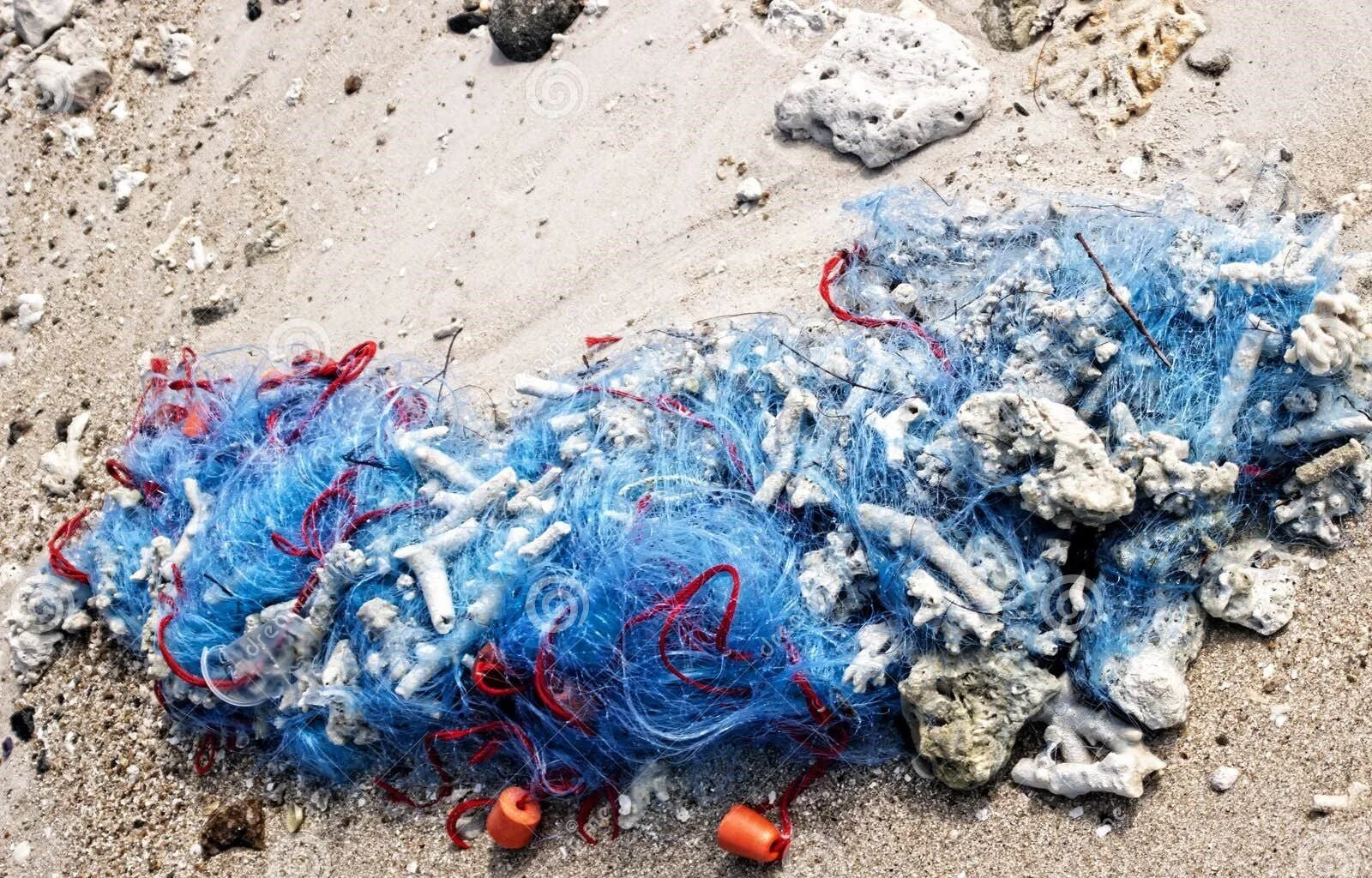
Source 6. Fishing net.
Source 7. Tourism development on the coast
Source 8. Development on the coast
7. Citizens protecting the coast
Background briefing: How can I help to conserve the coast?
If you are concerned about an issue such as coastal conservation.
You could approach the government responsible for the coast.
But first you will need to know how citizen participation works.
To do. Mapping political representation
Make a diagram that explains how the community and individuals can participate in and influence the political process in Australia.
Include each of the four steps shown in the slides with an example.
To do: Letter to the South Australian Premier
The Coast Protection Act 1972, (State Government), manages coastal hazards like erosion and development that affect the coast.
In your letter to the Premier, include the following.
Who you are and why you care.
Remind the Premier of why he can make a difference.
Describe the problems faced by the coast.
Explain why this is important
Propose a solution/action.
8. Coastal Conservation
Coastal Conservation Campaign - Protect our coastal landforms!
Another way that citizens can participate in Australian democracy is to volunteer for campaigns and community groups.
Imagine that you are members of a conservation group that is educating the public about how to prevent pollution at the coast.
Your Task:
Design a campaign to inform the public by completing one of the following:
Produce a group of posters
Design a pamphlet
Create a social media awareness campaign
Ensure that you include the following in your campaign project.
What is the name of your group?
Why do Coasts matter? Short explanation of coasts’ importance (biodiversity, tourism, recreation, cultural value).
Explain the main threats with examples: Erosion, plastic pollution, overfishing, habitat destruction.
Explain the sources of pollution on the coast, remember you are educating the public about their impact on the coast.
Explain the link between pollution and the effects on the coastal landforms and ecosystems, with examples.
How can you help? Dispose of plastic properly. What else?
Things to make your campaign better:
Before & after images: Healthy vs. damaged coastal environment.
Infographics: Simple charts EG the percentage of plastic waste entering oceans.
Catchy hashtags
Quotes from experts