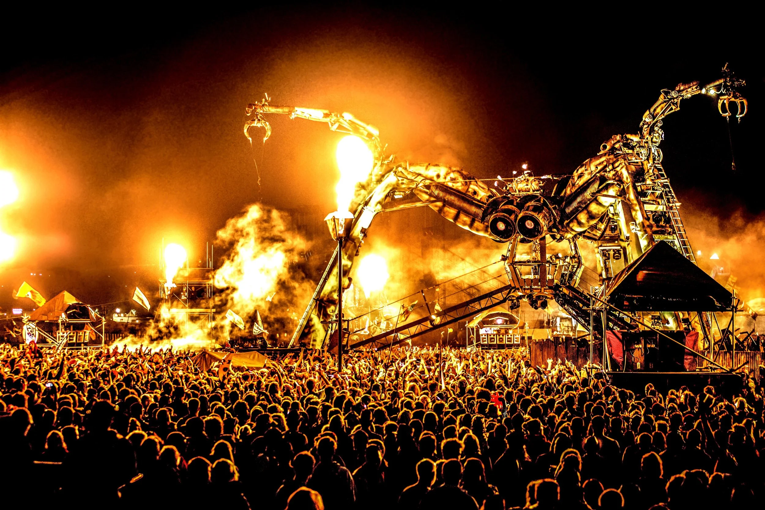
Belair Music Promotions Corporation
You have been asked to assess two sites for a music festival.
Your environmental impact assessment (EIA) must address two key questions.
Have you selected an appropriate site for a music festival?
Is it possible to create a sustainable music festival at Glenelg or Oaklands Reserve?
The following factors will be examined.
Tourism infrastructure
Impact on residents and local businesses.
Sustainability
Format:
You may choose to present your findings in one of the following ways:
Poster
Video
PowerPoint
Report
Putting it all together: Report Template (see below for how to complete your report)
Use the following outline to structure your fieldwork report.
1. Introduction
A brief summary of music festival tourism
The purpose of the fieldwork, include the two questions
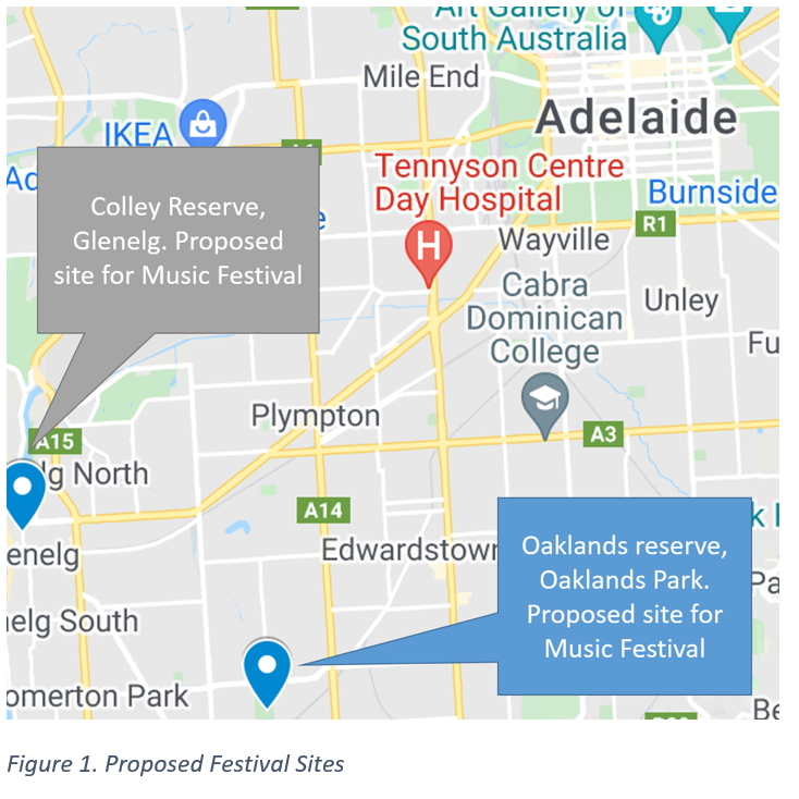
A map and satellite image of the two locations
2. Glenelg site analysis
Use the following subheadings for your discussion:
Map of the fieldwork sites
Site assessment
SWOT analysis of the proposed site
Proposed site plan
Transport and parking infrastructure analysis
Community survey analysis
Pedestrian count analysis
Local business survey analysis
Algal bloom community survey analysis
3. Oaklands Park site analysis
Use the following subheadings for your discussion:
Map of the fieldwork sites
Site assessment
SWOT analysis of the proposed site
Proposed site plan
4. Conclusion and Recommendations
Use dot points to summarise your findings and conclusions.
Make recommendations about the best site and the possible sustainability
Will the festival be likely to succeed? Why/why not?

How to do the Music Festival report
Introduction
The introduction includes the following:
A brief summary of the value of tourism in the SA economy.
The purpose of the fieldwork: Assess the Glenelg and Oakland's Park for a potential music festival.
A map and satellite image of the two locations
Map of the fieldwork sites
Fieldwork Aims
Do the sites have adequate tourism infrastructure?
Do the sites have sufficient transport infrastructure?
Is there a significant positive or negative impact on residents and local businesses.
Can the festival be promoted sustainably
How to do satellite images and GIS maps
Our Environmental Impact Assessment (EIA) will require visual tools to allow us to make a complete assessment of the two sites.
Open Google maps:
1. Search: Glenelg, Colley Reserve
2. Change the BaseMap to the Satellite view: Describe the location and the types of land use.
You will need the following maps for your report
○ Map of Oaklands Reserve AND Colley Reserve relative to Adelaide CBD
○ Satellite image of Colley Reserve and surrounding area
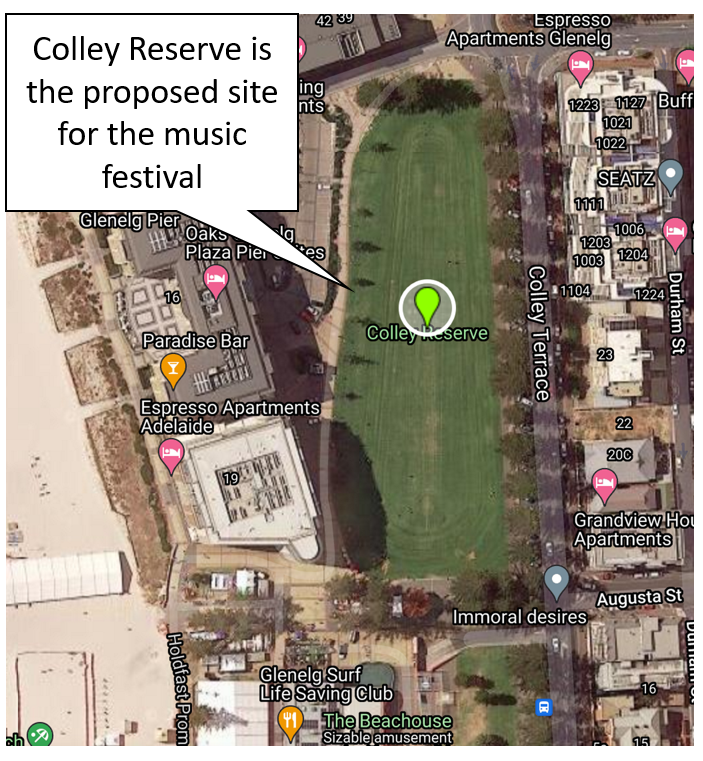
Colley Reserve (Glenelg) Analysis
Include the following in your analysis.
Google street view links for this location
Site assessment
SWOT analysis
Proposed site plan (see instructions below)
Transport and parking infrastructure analysis
Community survey analysis
Pedestrian count analysis
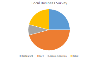
Local business survey analysis (see below for questions to answer)
Algal bloom community survey analysisSite assessment survey
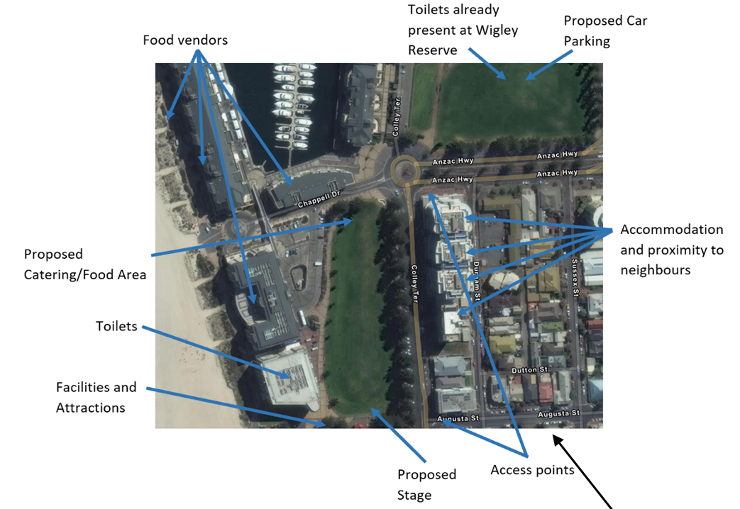
Proposed site plan - Colley Reserve
Go to Google Maps and screen shot a satellite image of Colley reserve and the surrounding area.
Annotate the following sites on your saved image
Toilet Facilities
Car and Coach Parks
Public transport facilities
Food and catering area
Stages
Facilities and attractions
Local business survey
Assess the capacity of existing tourism infrastructure to provide food and accommodation.
Where will people eat and drink?
Where will people stay?
How will the punters get to the festival?
Do the two sites have enough facilities for a music festival?
Oaklands Reserve Analysis
Include the following in your analysis.
▫ Google street view links for this location
▫ Site assessment survey
▫ Proposed site plan
▫ SWOT analysis
▫ Local business survey
Proposed site plan - Oaklands Reserve
Go to Google Maps and screen shot a satellite image of Oaklands reserve and the surrounding area.
Annotate the following sites on your saved image
Toilet Facilities
Car and Coach Parks
Public transport facilities
Food and catering area
Stages
Facilities and attractions
Local business survey - Streetview: Marion Rd. Oaklands
Assess the capacity of existing tourism infrastructure to provide food and accommodation.
Where will people eat and drink?
Where will people stay?
How will the punters get to the festival?
Do the two sites have enough facilities for a music festival?