The G of War
Background briefing: The G of War
Geography influences human conflict in the causes, planning and conduct of war.
Countries go to war for a variety of reasons:
○ Slaves
○ Farmland
○ Resources
○ Control of trade routes
○ Access to trade routes
○ Breathing space
○ Trouble at home
The following source analysis examines how physical and human geography shapes the strategy of war planners and the outcomes of periods of conflict.
1. The G of War
Source 1. Alexander the Great
For more than 200 years, the Persian empire ruled the Mediterranean world. The empire stretched from the borders of India to Egypt and the northern borders of Greece.
When Alex the Great marched into the Middle East against the Persians, everybody expected him to immediately enter a great battle against the enemy.
However Alexander had a strategy..
But for the next two years he focussed on capturing port towns on the Aegean and Mediterranean coasts cutting Persia’s trade with the rich Mediterranean.
He then conquered Egypt and its massive wheat granaries. Causing famine in the empire.
His enemies thought he was fearful and avoiding battle. However, when the two armies met at Gaugamela in 331 BC, the 50 000 strong Greek army destroyed the 250 000 soldiers of the Persian army.
The battle resulted in the complete conquest of the Persian empire by Alexander.
Questions
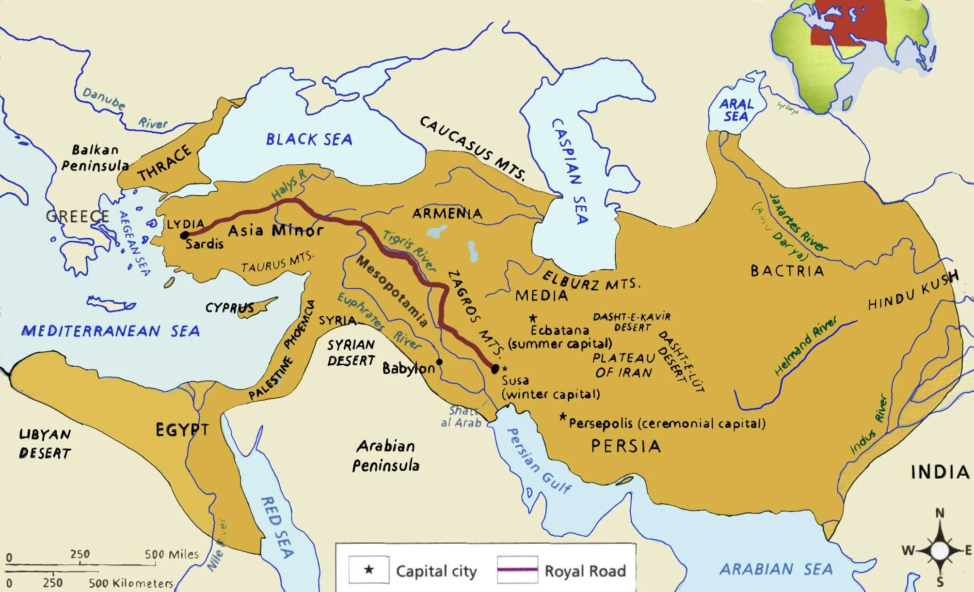
Use a map of the Persian empire to explain Alex the Great's strategy in his Persian campaign considering the following important factors.
The importance of Mediterranean trade to the wealth of the Persian empire.
The importance of the Royal Rd (Hint: trade with the Mediterranean)
The importance of Egypt's grain harvest
How the loss of these assets impacted the ability of the Persian Empire to wage war.
Source 2. The Cold War and the Middle East
After WW2, a process of decolonisation led to the creation of many new countries. The British and French, who had inherited the Ottoman colonies in the region, fulfilled their wartime promises by evacuating and recognizing the sovereignty of the new Middle East new nations.
However, independence was complicated by two things. First, the regions extensive oil and gas wealth and second the importance of the trade routes that passed through the region.
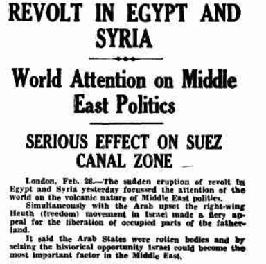
During the Cold War, the USA and Russia competed for control of the region, supporting and destabilising governments to achieve their respective aims. The USA has maintained strong relations with Saudi Arabia (the world's largest oil reserves) while being associated with coups in Egypt, Syria, Iran and Iraq (Three times).
Questions
How does geography influence US policy in the Middle East?
What are the benefits of controlling access to oil and gas in the global economy?
Source 3. The Suez Canal
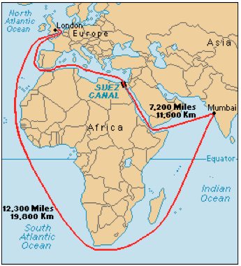
The Suez Canal allows trade between the Indian Ocean and Europe and the Atlantic Ocean, to avoid the lengthy and often dangerous voyage around the bottom of Africa (Cape Horn). The canal replaced land based caravans that unloaded ships in the Gulf of Aquaba and reloaded in Port Said on the Mediterranean coast.
Click here to view the Suez Canal
Questions
Use a satellite image/map to explain the geopolitical importance of the Suez canal.
Source 4. China's global trade network
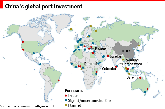
China has become the world's largest trading country and second largest economy, and conducts about 95 percent of its international trade through sea lanes. President Xi has emphasised the importance of ports for economic development stating that "We often say that to get rich we must first build roads; but in coastal areas, to get rich we must also first build ports."
Of the world’s ten largest ports, seven are in China.
In addition China controls or operates 129 port projects around the world.
Questions
Explain the importance of China's global port investment to the Chinese economy
What are the strengths of this strategy?
What are the weaknesses of this strategy in the event of conflict with another country?
Source 5. Shatter zones - The art of not being governed
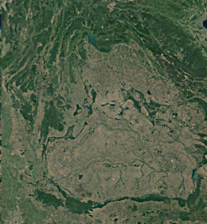
James Scott’s “The Art of Not Being Governed: An Anarchist History' argues that hill tribes migrate to mountainous regions such as Zomia in upland Southeast Asia, an area roughly the size of Europe as a refuge or shatter zone. They are fleeing state expansions and associated slavery, conscription, taxes, epidemics, and war. He argues that the community organisation and agriculture are designed to resist being absorbed by nation state empires.
Questions
Use the satellite image to describe the reasons Hill tribes were able to avoid control by the Khmer, Thai and Chinese empires. Consider physical and human factors
Upland South east Asia - Zomia
2. The G of Power
Why are some countries more powerful than others?
To do: Use your geographical knowledge to explain why the USA and China are able to project power and influence globally.
Use data, graphs and maps to explain the geographical advantages enjoyed by the two superpowers
Which countries have the best agriculture? (Hint: largest grain production)
Which countries have the largest river networks? (Trade)
How does the USA influence global trade? (Navy and control of choke points?)
How does China influence global trade? (Shipping and ports?)
Who has the most influence over global resources? (Location and influence)
Background briefing: Theories of Power
The Heartland theory. Mackinder 1909
The Rimland Theory. Spykman 1940
The World Systems Theory. 1980
3. Gladstone invasion planning
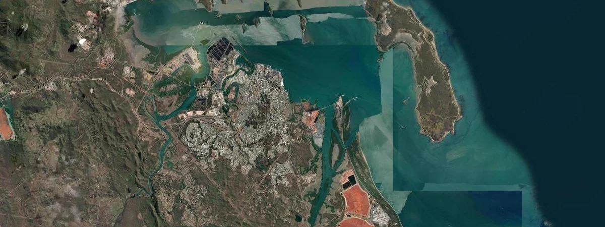
Refer to the Gladstone topographic map
A terrorist enclave in Area A has been launching drones and bombs to disrupt the Gladstone refinery and export facilities.
A decision has been made to invade the area and secure the site.
To do: Make a plan for the assault using the topographic maps and satellite images.
What can be found at GR 184514?
What is the direction of Point Y (GR 214 557) from point X?
What is the vegetation type in Area A. How will this impact ground forces?
Describe the topography in Area A. How will this impact the ground forces?
When our special forces soldiers land at the airport (GR 193590) they will need clear instructions for the route to the entry point at Area A. (GR 206551).
Include 6 specific instructions.
The navy will be bombing Area A from Area B. What are the bearings of the target (Area A) from Area B.
What is the distance of the target (Area A) from the launch point GR 355525 (Area B)
Suggest a suitable location for the expected refugees from the invasion.
Give a minimum of 6 justifications for your choice of location.
Examine the satellite image of Gladstone and compare it with the topographic map. What are the benefits of using a satellite image that you cannot see on the topographic map.