Disparities
The problem with Disparities.
Disparities are differences or inequalities between places or groups of people in things like wealth, access to resources, services, opportunities, and quality of life.
In Geography, we study disparities by comparing development outcomes using indicators.
Disparities between countries: LEDC vs MEDC
Disparities between regions within a country: Urban vs rural
Disparities between groups of people (income, education, health access)
To do: questions
What are five examples of indicators that could be used to investigate disparities between countries?
What are five examples of indicators that could be used to investigate disparities between regions within a country?
What are the barriers to reducing disparities between a) Countries, b) Regions and c) Groups
Extra: Who should be responsible for reducing disparities between regions/groups in an MEDC?
1. Disparities in Australia
Activity 1: Investigating disparities in Australia
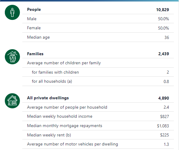
The Australian Bureau of Statistics (ABS) is an excellent source of geographical and population data that can help a Geographer examine trends and disparities in wellbeing for regions, towns and suburbs in Australia.
Indicators and maps based on this data allow us to visualise the wellbeing of a population.
In this activity you will compare the wellbeing of your suburb with another suburb or town using data from the ABS.
To do: Disparities with the ABS
Download the ABS indicator table to your computer: ABS indicators
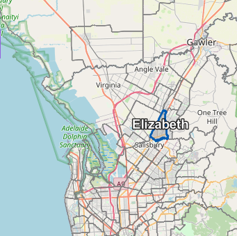
Complete the ABS indicators for your suburb and One of the following towns or suburbs
(click the link for the community profile)
Disparities analysis
a. Identify three key examples of disparities between Blackwood and the other town/suburb.
b. Suggest three causes of the disparities you have identified.
d. Suggest a solution to one of the disparities you have identified.
Discuss: Why do disparities exist in wealthy countries such as Australia?
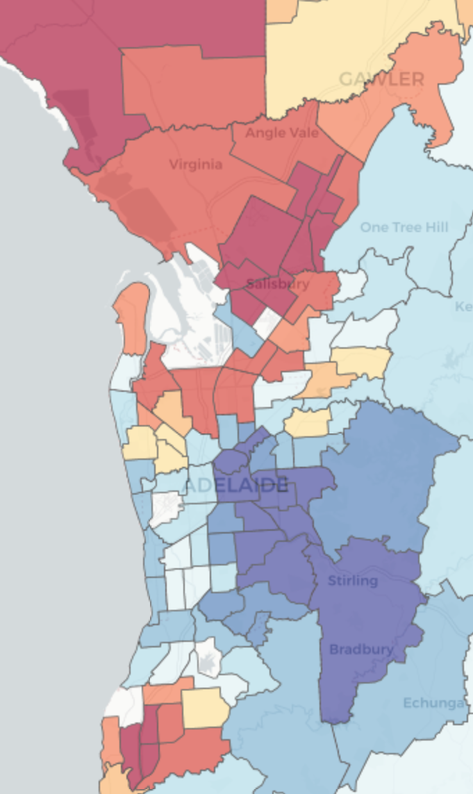
Activity 2. Using the SEIFA index to visualise disparities in SA.
Socio-Economic Indexes for Areas (SEIFA) is an ABS product that ranks areas in Australia according to relative socio-economic advantage and disadvantage. The indexes are based on information from the ABS census and government agencies.
To do: The SEIFA index analysis
What is the SEIFA index?
Click here for The SEIFA Index Map
Describe the spatial distribution of disparities in South Australia.
What are three key observations about possible causes of disparities from the map?
Locate the two suburbs from the previous activity and screenshot both of your locations.
Record the relative SEIFA scores, ranks and percentiles for both locations.